The Shops down Angel Lane
By about 1970 Angel Lane was little more than a memory. As was often the case the ‘redevelopments’ of the period made little or no attempt to record or document what was essentially erased from history – if not from memory! In later years the new developments built in the area were, themeselves, bulldozed and re-redeveloped a few decades later. As a result now it is now a challenge to even locate where things were at the time. Few people in the area owned a camera. And those who did were unlikely to take and keep photos of the streets or the Angel Lane market. If you lived there or nearby it was ‘there every day’ so taken for granted... until it was gone!
Hence it becomes now something of a combined detective story and a subject for ‘Time Team’ archaeology to determine what Angel Lane was like. However by combining information from various sources with my own recollections it is possible to get some impression of what the shops and Lane were like sixty years ago.
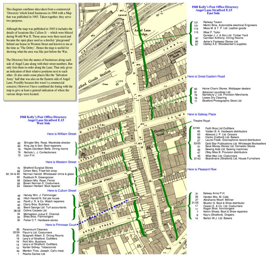
The above image shows a section taken from a map of the area that was published in 1945. Down each side of the map I have added a list of the shops, in street-number order. These come from a directory published in 1968. N.B. By clicking on the above image you can see a much larger version that shows the details more clearly.
The following photos were all taken in the first half of the 1960s and show some parts of Angel Lane. These give some idea of what the shops and Lane looked like at the time. But unfortunately, they don’t show all of Angel Lane, nor any of the adjacent streets.

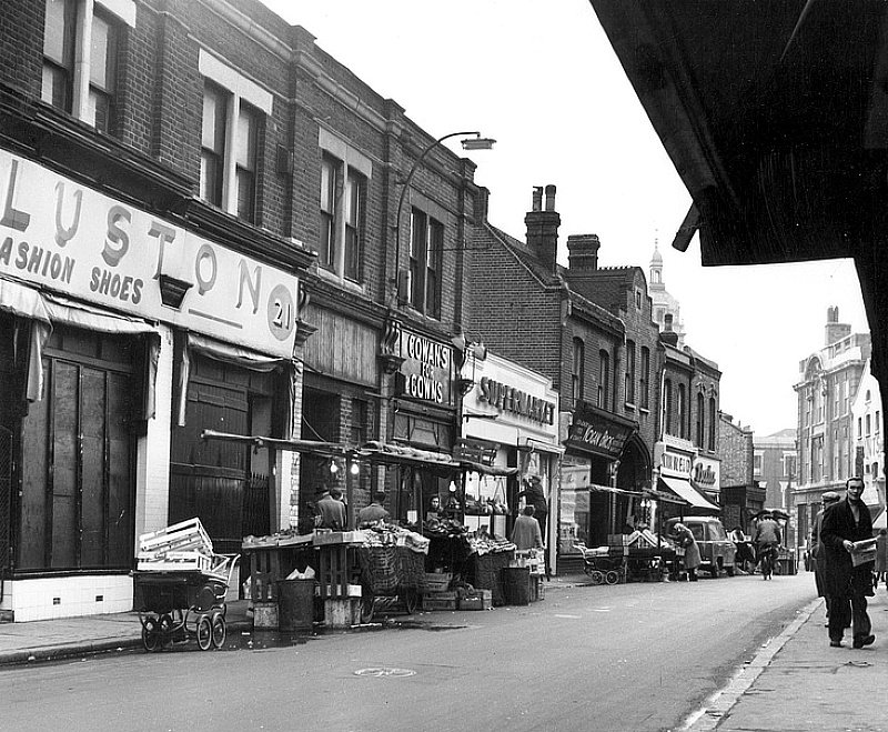
The above photo shows the part of the Eastern side of Angel Lane from “Bluston’s Shoes” down towards Stratford Broadway. With the market stalls also present.

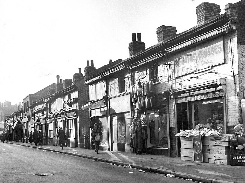
This photo shows the Western side of the Lane, from Dobson’s Flower Shop down towards the Broadway. At the nearest corner of Dobson’s we can just see part of a charity-collection ‘box’ and the edge of a vending machine. The corner of the shop and these items lead me to think that just out of view on the right was a ‘set back’ part of the pavement. i.e. the shops just out of view are further from the roadway. This added area of space allowed retailers to place barrows on the paved area between the pavement and the fronts of the shops – Ruddocks to Cohen’s Fish Bar – to sell from the barrows as well as the shops. My recollection is that there were two vending machines. One dispensed cooled Milk and the other ‘Frozen Jubblies’ (frozen orange juice in tetrapacks.) I occasionally bought a Jubblie from the machine. In those days few people in the area owned a fridge. So the cooled milk was sometimes handy if someone had run out. The ‘Jubblie’ machine was mainly targetted at children.

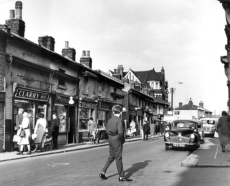
The photo above also shows the Western side of the Lane, but now looking the other way along the Lane. In this view we can see Clarry’s the butcher’s shop on the right and the section up towards ‘The Lion’ public house on the far corner of Western St. The pub was also set back from Angel Lane and as a result we can also just see Nichol’s sweet shop and the section as far as Shingler’s – which in my recollection was a ‘rag and bone’ shop. One where I bought my first books – secondhand paperbacks at 3d or 6d. (Ye olde money where 240 pence made one Pound!)
Unfortunately – apart from the glimpse of Nichol’s – the photos don’t show the shops that I can recall going into. I can recall Laurie’s Record Shop as I bought my first 45 single records there. Examples like various discs from The Shadows and other groups like The Searchers, The Beatles, etc. Nichol’s also used to sell comics like The Beano, Eagle, etc, plus ‘Superman’ and other American cartoon/graphic fiction magazines. In addition a clothing shop that isn’t shown in the photos also sold American comics like "Casper the friendly Ghost’.
My thanks go to Stephen Laurie who sent me the information from the 1968 street guide. That information prompted me to generate this webpage.